
![]()

 |
||
 |
Archibald C. Gresham Co. D, 22nd Illinois Volunteer Infantry |
 |
 |
||
Great-Granddad's HouseAt first thought, it's hard to imagine using GPS to follow the path of a Civil War soldier, but that's exactly what my father and I did last year.
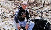
My dad and I wanted to find the remains of Archibald's farm and log cabin. We knew from a previous visit to the area that it was "up on Penitentiary Mountain," our only clue. On the appropriate U.S. Geological Survey (USGS) topographic map, Penitentiary Mountain is clearly shown but encompasses several square miles. To complicate matters further, the area is very remote, and its landscape has been altered by timbering and farming. Dad began our "expedition" with a search through old land records. He located the legal description of his grandfather's farm, as defined by the Arkansas land survey (coordinate) system. I then plotted that parcel onto the USGS 7.5-minute topographic map. Using the Universal Transverse Mercator (UTM) grid ticks on the map, I recorded the UTM coordinates of the property corners, possible cabin sites, the nearest public roads, and easy-access paths or trails and programmed them into my GPS unit. Having obtained landowner permission, we used my receiver to navigate through the maze of farm and logging trails until we were at the boundary of Great-Granddad's old farm. At the first hint of an old woods road, now overgrown, we followed it about 100 meters and found the cabin foundation. The cabin burned down in the early 1950's, but the fieldstone foundation, water well, and collapsed chimney were unmistakable. I took several GPS readings on the property and am confident I could again locate the site many years hence, despite future alterations to the land. Without GPS, the task might well be impossible. |
Researched by Henry C. Gresham, a WWII veteran and grandson of
Archibald C. Gresham.
Submitted by his son, Henry
W. Gresham.
Comments and administrative-type problems or for suggestions, concerns or complaints
regarding a specific web site within the ILGenWeb Project, should be emailed to the State Coordinator
 Archibald Columbus Gresham, my great-grandfather, served three years
in the Twenty-second Illinois Infantry Regiment, USA. He fought in Chickamauga,
Resaca, Stone's River, and many other battles. After the war, he married
and settled in Madison County, Arkansas, to farm and raise a family. He
died in 1882.
Archibald Columbus Gresham, my great-grandfather, served three years
in the Twenty-second Illinois Infantry Regiment, USA. He fought in Chickamauga,
Resaca, Stone's River, and many other battles. After the war, he married
and settled in Madison County, Arkansas, to farm and raise a family. He
died in 1882.